ICA joins the OGC as Associate Member

The ICA recently joined the Open Geospatial Consortium (OGC) as an associate member. As an international consortium of more than 500 businesses, government agencies, research organizations, and universities, the OGC focuses on the interoperability of geospatial data, applications and services “to make geospatial (location) information and services FAIR – Findable, Accessible, Interoperable, and Reusable” (https://www.ogc.org/).

OGC membership makes it possible for ICA Commission Members to participate in standards development and gives them access to member-only content in the OGC portal. This includes attendance and participation in OGC meetings, voting rights in working groups, and insight into geospatial technology trends with recommendations for actions in the technology forecast report. Additional benefits are the awareness and promotion of the ICA and cartography to a broader public and further intensified contact with leading geospatial organisations.

The Commissions on SDI and Standards, Cognitive Issues in Geographic Information Visualization and Open Source Geospatial Technologies have started regular discussions to coordinate the ICA’s involvement in the OGC. We think that the ICA can make a particular contribution to the standardization of cartography-specific terminology and by bringing in a user-centred perspective to the technical standards of the OGC through communicating our understanding of what design choices are effective. We are considering organizing a workshop attached to the ICC2021 where we can discuss and share our ideas with others in the ICA community.

Posted in OGC

Revised Dates for Papers and Abstracts for ICC2021

The dates for the ICC2021 in Florence Italy have been moved from July to December 14-18, 2021 in response to the current effects of the pandemic. With this extended period, the ICC2021 Local Organizing Committee very recently revised the dates for submitting full papers and abstracts. The new dates are posted on the website and also are provided below:

Full Papers Submission Closing March 19, 2021
Abstracts Submission Closing May 28, 2021
Notification Of Acceptance For Full Papers July 2, 2021
Notification Of Acceptance For Abstracts July 2, 2021
Submission Of Final Manuscripts July 30, 2021

Welcome for the first commission member from Zambia

We weclome a new member in our Commission: Gillie Cheelo!

Gillie Cheelo is currently working as a lecturer at the Copperbelt University teaching Cartography, remote sensing, and GIS. Holds a master of science degree in Photogrammetry and Geoinformatics, a Bachelor of Science degree in urban and regional planning, post-graduate certificates in rural and peri-urban land administration, sustainable land use planning, and climate change. Through his advanced training in Germany and experience, has developed a unique combination of skill set in geoinformatics, photogrammetry, remote sensing, and one of the recognizable GIS experts in Zambia. After attaining his Masters of Science Degree, he has risen quickly from being a GIS Technical Officer to being a GIS Specialist, then Chief Cartographer and now works at the Copperbelt University as a Lecturer sharing his knowledge and practical experience.

Gillie Cheelo |GIS/Remote Sensing and Land Use and Land Cover Change Expert

Gillie Cheelo from Zambia, |GIS/Remote Sensing and Land Use and Land Cover Change Expert

Some of his ardent achievements are awarded for his hard work and commitment with a Carey Eaton Mission award in 2018. Further, he has contributed to the setup of the first operational seamless integrated GIS System which includes Desktop GIS, Web GIS, and Mobile GIS system using ArcGIS Software suite – for Mulonga Water and Sewerage Company Limited and part of the team setting up GIS at the Provincial Planning Office in Zambia.

New venue for pre-ICC workshop SDI-Open 2019

We are very glad the SDI-Open 2019, which is going to take place next Monday, is now easily to reach from the ICA conference hall.
The new location is Rooom Mars, Miraikan – National Museum of Emerging Science and Innovation (conference venue). More details can be found here and on OpenStreetMap.

Registration is still possible here.

Here is the updated and extended programme.

Invitation: 3rd International Workshop on Spatial Data Quality

Valletta SkylineFollowing previous successful workshops in 2015 and 2018, EuroGeographics and EuroSDR, in conjunction with OGC, ISO and ICA, are pleased to announce a third workshop on spatial data quality, to be held in Valletta, Malta on the 28th and 29th January 2020. The announcement and more information about the workshop is available here.

Timelines:

  • 31st May 2019 Workshop Announcement and call for papers
  • 1st August 2019 Website opens for paper submission
  • 1st October 2019 Deadline for submission of content
  • 29th November 2019 Notification of acceptance / rejection of papers
  • 6th January 2020 Deadline for submission of final versions
  • 28th/29th January 2020 Conference in Malta

Announcement: SDI-Open 2019

SDI-Open 2019, the pre-conference workshop on spatial data infrastructures, standards, open source and open data for geospatial will be held on 15 July 2019 in Tokyo, Japan, immediately before the 29th International Cartographic Conference. The workshop is jointly organized by our Commission on SDI and Standards, the Commission on Open Source Geospatial Technologies and the Commission on Map Production & Geoinformation Management.
Continue reading

Invitation to OGC workshop in Windhoek, Namibia

After the workshop at University of Pretoria in September, the ICA Commission on SDI & Standards, will organize again a two-day workshop on OGC specifications, 07-08 Nov 2018, presented by Prof Franz-Josef Behr from the Stuttgart University of Applied Sciences (Germany), Co-Chair of the Commission. Delegates will be introduced to the technological foundations behind of OGC specifications, there will be hands-on sessions with specific implementations of OGC specifications, and an outlook into the future of OGC standardisation developments.

The workshops is co-organized by the Namibia Statistics Agency, coordinator of the NSDI for Namibia, and is part of the AGSE 2018 conference.

The programme for the workshop, to be held at the Namibia University of Science and Technology (NUST) on 08 and 09 November 2018 provides more details. If you would like to participate, please contact Franz-Josef Behr.

Collaborative custodianship through collaborative cloud mapping

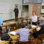
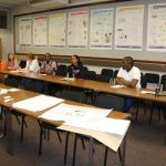
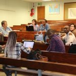
Presentations and photos from the workshop…

Introduction to collaborative cloud mapping by Peter Schmitz, Chair: ICA Commission on Map Production and Geoinformation Management

Introduction to collaborative custodianship by Serena Coetzee, Chair: ICA Commission on SDI & Standards

Introduction to the South African SDI (SASDI) by Maroale Chauke, Secretariat: Committee for Spatial Information, Directorate: NSIF

Introduction to collaborative data custodianship in SASDI by Nicolene Fourie, Chair: Data Subcommittee of the Committee for Spatial Information

Case study: Collaborative custodianship of the Basisregistraties Adressen en Gebouwen (BAG) in the Netherlands by Martijn Odijk, Project Manager: Policy Geo Information (National SDI), Ministry of the Interior and Kingdom Relations, Netherlands

Case study: Collaborative custodianship of the Centraal Referentieadressenbestand (CRAB) in Flanders by Ziggy Vanlishout, Programme Manager: Authoritative Data Sources, Informatie Vlaanderen, Flanders, Belgium

Case study: Collaborative cloud mapping for federal address and street network datasets in Austria by Markus Jobst, Co-Chair: ICA Commission on Map Production and Geoinformation Management

Collaborative mapping with the Humanitarian OpenStreetMap Team (HOT) by Frikan Erwee, UP Alumni, Former President of the YouthMappers Chapter at UP